Shelter in a Storm, India’s Urgent Need for a Robust Early Warning System Against Climate Vagaries
Introduction: A Nation Under Siege by the Skies
The monsoon, the lifeblood of the Indian subcontinent, is transforming. The gentle, life-giving rains of lore are increasingly punctuated by violent, unpredictable, and catastrophic weather events. From the high Himalayas to the sprawling megacities on the coast, India is witnessing a new era of climatic fury. The recent tragedies in Jammu and Kashmir, where over 60 lives were lost to cloudbursts in less than a week, are not isolated incidents. They are part of a distressing pattern of devastation that has repeated itself this year in Uttarakhand, Himachal Pradesh, and the Northeastern states.
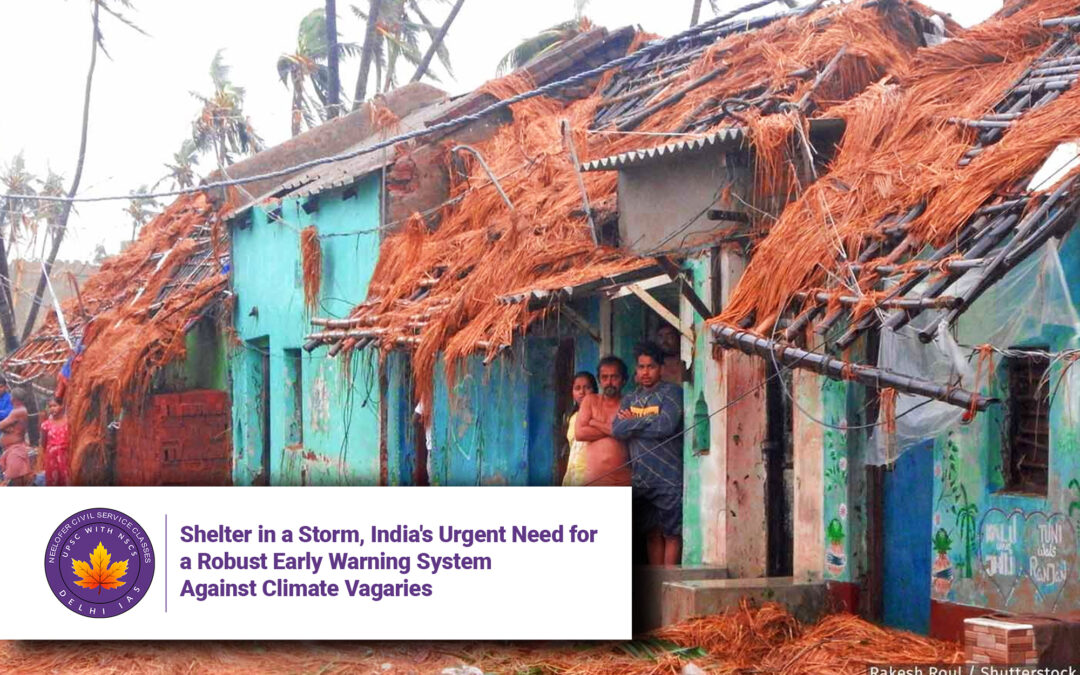
This is more than a seasonal inconvenience; it is a national emergency that exposes a critical vulnerability in India’s infrastructure and disaster preparedness framework. While the immediate images are of flooded streets, collapsed homes, and stranded communities, the underlying story is one of a systemic failure to adapt to a new climate reality. The need of the hour is not just reactive relief measures but a proactive, technologically advanced, and meticulously implemented network of early warning systems designed to shield people from the vagaries of a changing climate. This article delves into the nature of the threat, the inadequacies of the current response, and the multifaceted strategy required to build a resilient India.
The Anatomy of a Cloudburst: Understanding the Enemy
To build an effective defense, one must first understand the adversary. A cloudburst is one of nature’s most intense and localized displays of power. Meteorologically, it is defined as an extreme amount of rainfall, typically 100 mm or more, in a very short span of time over a relatively small geographical area (approximately 20-30 sq km). To put this in perspective, 100 mm of rain is what some entire regions receive over a month; a cloudburst dumps it in an hour.
The mechanism behind a cloudburst is a complex atmospheric drama:
-
Rapid Condensation: Warm, moisture-laden monsoon winds from the Arabian Sea and the Bay of Bengal are forced upwards when they encounter a barrier, like the Himalayan mountains.
-
Orographic Lifting: As the air rises, it cools, and the moisture within it condenses at an accelerated rate to form massive cumulonimbus clouds.
-
The Perfect Storm: The interaction with colder winds and the unique, rugged topography creates a volatile mix. The cloud, now over-saturated with water droplets and ice crystals, becomes unstable.
-
The Deluge: When the upward air currents can no longer support the weight of the condensed water, the cloud “bursts,” unleashing a torrential downpour of unimaginable intensity over a very concentrated zone.
Climate change acts as a malevolent catalyst in this process. A warmer atmosphere holds more moisture—for every 1°C rise in temperature, the air’s capacity to hold water vapor increases by about 7%. This simple thermodynamic principle means that when it rains, it can pour with exponentially greater force, turning what were once rare events into frighteningly frequent occurrences.
The Fallout: Beyond the Immediate Deluge
The impact of a cloudburst is never localized to the 30 sq km it directly hits. It acts as a trigger for a cascade of secondary disasters:
-
Flash Floods: The dry, mountainous soil cannot absorb such a sudden deluge. The water immediately runs off, gathering immense force and volume as it surges down slopes and valleys, sweeping away everything in its path—roads, bridges, vehicles, and entire villages.
-
Landslides: The torrential rain destabilizes hill slopes, saturating the soil and triggering devastating landslides that bury homes and block critical highways, often cutting off access for rescue and relief operations.
-
Urban Flooding: In cities, the problem is different but equally destructive. Inadequate, antiquated, and clogged drainage systems are instantly overwhelmed. The result is the now-familiar scenes of urban paralysis: waterlogged streets, submerged infrastructure, disrupted power and water supply, and crippled traffic, as witnessed repeatedly in Delhi, Mumbai, and Bengaluru.
The human cost is staggering—loss of life, displacement, destruction of livelihoods, and long-term psychological trauma. The economic cost, in terms of damaged infrastructure and lost productivity, runs into billions of dollars annually, setting back development goals by years.
The Systemic Gap: Why We Are Consistently Caught Off Guard
The repeated loss of life points to a critical failure in India’s disaster management architecture. The challenges are multifaceted:
-
The Forecasting Challenge: Predicting a cloudburst with pinpoint accuracy is notoriously difficult. It requires forecasting not just if it will rain, but where, when, and how much with a level of granularity that pushes the limits of modern meteorology. The India Meteorological Department (IMD), while highly skilled, often lacks the hyper-local data needed. The very nature of these small “rain bombs” means they can occur between the gaps of a weather observation network.
-
The Last-Mile Communication Problem: Even when a warning is generated, ensuring it reaches every single individual in the threatened remote village or urban neighborhood in a timely and understandable manner is a Herculean task. Warnings can get lost in bureaucratic channels, fail to overcome language and literacy barriers, or simply not convey the urgency required for people to take immediate action.
-
Defective Urban Planning and Land Use: Perhaps the most egregious failure is on the planning front. There has been a reckless disregard for ecology and hydrology. Construction on floodplains, deforestation on hill slopes, the concreting over of natural water absorption systems (wetlands, lakes, and green spaces), and illegal mining in riverbeds have dramatically increased our vulnerability. We have systematically destroyed the natural buffers that once mitigated such events.
-
A Reactive, Not Proactive, Mindset: Disaster management in India has historically been focused on post-disaster relief and rehabilitation. While this is crucial, it is akin to treating the symptom while ignoring the disease. A paradigm shift towards prevention, preparedness, and early warning is urgently needed.
Building the Shield: A Multi-Pronged Strategy for Resilience
Addressing this challenge requires a war-footing approach and a coordinated national mission. The solution lies in a multi-pronged strategy:
1. Technological Augmentation:
-
Hyper-Local Doppler Radar Network: India must rapidly expand its network of Doppler Weather Radars (DWRs), particularly in the Himalayan states. DWRs can detect the formation and movement of intense cloud systems and provide crucial lead time of minutes to hours.
-
Denser Automatic Weather Stations (AWS): Deploying a much denser network of AWS and rain gauges in vulnerable areas will provide the ground-truth data needed to validate forecasts and improve model accuracy.
-
Advanced Computing and AI: Leveraging high-performance computing and artificial intelligence to run complex weather prediction models at a very high resolution can significantly improve forecast accuracy for extreme events.
2. Revolutionizing Early Warning Communication:
-
Cell Broadcast Technology: Instead of relying on SMS, which can get delayed in congested networks, implementing cell broadcast technology can send geographically targeted warning messages to every mobile phone in a threatened area simultaneously, like the Amber Alert system.
-
Community-Based Systems: Empowering local communities with simple, low-tech warning systems—such as sirens, designated volunteers with megaphones, and coded flags—can ensure the message gets through even when technology fails.
-
Clear and Actionable Messaging: Warnings must be in local languages and must clearly state what the threat is, how severe it will be, what time it will hit, and exactly what actions people need to take (e.g., “evacuate to higher ground immediately”).
3. The Imperative of Climate-Proof Planning:
-
Vulnerability Mapping: Creating detailed, high-resolution maps that identify cloudburst-prone zones, flood plains, and landslide-risk areas using historical data and satellite imagery is the non-negotiable first step.
-
Enforcing Land-Use Laws: These maps must form the basis of stringent land-use regulations. Construction and infrastructure projects in high-risk zones must be heavily restricted or designed with robust climate-proofing measures.
-
Overhauling Urban Drainage: Cities need a massive upgrade of their drainage systems, not just to handle current capacity but to future-proof them for more intense rainfall. This includes decongesting existing drains, creating new channels, and reviving natural water bodies that act as sponges.
Conclusion: An Investment in Survival
Building a nationwide, state-of-the-art early warning system is not an expenditure; it is one of the most critical investments India can make in the security and well-being of its citizens. It is a moral imperative. The technology exists, the expertise is available, and the need is painfully evident. What is required now is the political will, bureaucratic efficiency, and public awareness to weave these threads into a resilient shield.
The storms will continue to come. The question is whether we will continue to be their helpless victims or finally build the shelter we so desperately need. The time for ad-hoc responses is over. The era of systemic, scientific, and swift resilience must begin now.
5 Q&A on India’s Early Warning Systems and Climate Resilience
Q1: What exactly is a cloudburst, and why is it so dangerous?
A1: A cloudburst is a sudden, extremely intense rainfall event where 100 millimeters (10 centimeters) or more of rain falls within an hour over a small area, typically around 20-30 square kilometers. Its danger lies in its intensity and localization. The dry ground cannot absorb water that quickly, leading to immediate, devastating runoff that causes flash floods and landslides. The force of the water can wipe out entire villages, roads, and bridges in minutes, often with little to no warning.
Q2: Why is it so difficult to predict cloudbursts accurately?
A2: Predicting cloudbursts is a major meteorological challenge due to their hyper-local nature. They are caused by highly localized and rapidly developing weather systems that can form in the gaps between weather observation instruments like radar and weather stations. Standard forecast models work on a larger scale (e.g., for a district) and can predict heavy rainfall but often cannot pinpoint the exact town or valley that will be hit with cloudburst-level intensity until it is almost too late.
Q3: What is the difference between a weather forecast and an early warning system?
A3: A weather forecast provides information on what the weather is likely to be (e.g., “heavy rain expected in Rudraprayag district tomorrow”). An early warning system is an integrated process that takes a forecast and translates it into actionable information. It involves:
-
Monitoring and Forecasting (detecting the threat).
-
Risk Analysis (determining who is in danger and what the impact will be).
-
Dissemination & Communication (getting a clear warning to those specific people).
-
Response Capability (ensuring communities and authorities know what to do when they receive the warning). A forecast is just the first step; a warning system saves lives.
Q4: Besides better technology, what else is needed to protect people from cloudbursts and floods?
A4: Technology is only one part of the solution. Two other critical components are:
-
Land-Use Planning: This is the most important preventative measure. Authorities must use historical data and vulnerability maps to strictly prohibit construction and infrastructure development in high-risk zones like floodplains and steep, unstable slopes. Continuing to build in these areas puts people directly in harm’s way.
-
Community Preparedness: Local communities must be trained and equipped to respond to warnings. This includes having evacuation plans, identifying safe shelters on high ground, and conducting regular drills so everyone knows what to do when a warning is issued.
Q5: How can an individual stay safe during extreme rainfall events?
A5: Individuals can take several steps:
-
Stay Informed: Pay attention to weather forecasts and official warnings from the IMD and local disaster management authorities on TV, radio, or official apps.
-
Understand Risk: Know if you live in a low-lying area, near a river, or on a hill slope.
-
Have a Plan: Know your evacuation route and where the nearest safe shelter is.
-
Avoid Risk: Do not walk or drive through flooded streets. Just 15 cm of moving water can knock you off your feet, and 30 cm can sweep away a vehicle. Do not take shelter under trees or near unstable slopes during heavy rain.
-
Prepare an Emergency Kit: Have a bag ready with essential medicines, important documents, water, food, a flashlight, and a whistle.